Application of Drone in Agriculture
Almost every area of our lives may be transformed by technology. In many sectors, it increases efficiency by lowering workload and necessary time. Agriculture is no different from other industries. A large number of people have been displaced into other high-productivity industrial sectors as a result of the growing automation of agricultural operations, which has greatly increased labor productivity in agriculture. Since then, technological advancements in many other applied disciplines, including chemistry, genetics, robotics, and many others, have hastened the development of agricultural technology. In agriculture, drones are still a relatively new technology, yet they have the power to completely change how farmers work. Drones can increase agricultural yields, save expenses, and preserve the environment by automating jobs and giving farmers more information.
In actuality, agricultural output has significantly grown in recent years. However, there is expected to be an even greater growth in demand for agricultural goods, with estimates of aggregate agricultural consumption rising by 69 percent between 2010 and 2050. This increase will mostly be driven by the increase in the world’s population from 7 to 9 billion people during this period. This pressing demand for more agricultural productivity can only be met with a technological response, and that response is the only one that is realistic. With the capabilities it offers, drone technology and sophisticated picture data analytics might play a significant role in the technological mix that closes the gap. Agricultural production now and anticipated future demands.
Drone technology applications in cutting-edge picture data analytics: The agriculture sector may benefit from a variety of drone technology applications that combine cutting-edge picture data analytics. The addressable market for drone applications in agriculture was recently estimated to be worth USD 32.4 billion. Drones are used in the majority of applications as a transportable, airborne platform for gathering sophisticated picture data. Drones may be equipped with a variety of image data sensors depending on the needs of the specific project. Assessing the health of agricultural plants is the most often used use for picture data from drones. Agriculture claims management is one of the primaries uses for drone technology that is being used in insurance more and more frequently nowadays. The counting and inventorying of animal herds is another less obvious use for drone photography and mapping capabilities. Every animal is represented by a distinct heat mark when high resolution infrared cameras are used, which increases the accuracy of counting compared to traditional approaches. More complex activities are now possible thanks to the development of infrared camera apps for herd monitoring. A high-resolution infrared camera used to focus on a single animal allows for quick detection and treatment of sick animals by comparing the temperature of the animal to another.
The field of drone technology is constantly changing and developing, as are picture data processing and analytics. In the upcoming years, a number of technologies that are now under development have the potential to completely change the industry. Most likely, this would prompt the creation of brand-new agricultural applications right away or a heightened influence of UAV technology in already-existing ones. One of the best examples is the quick advancement of deep learning and machine learning. The processing and analyses of picture data are moved from people to trained algorithms through automation of cognitive capacities.
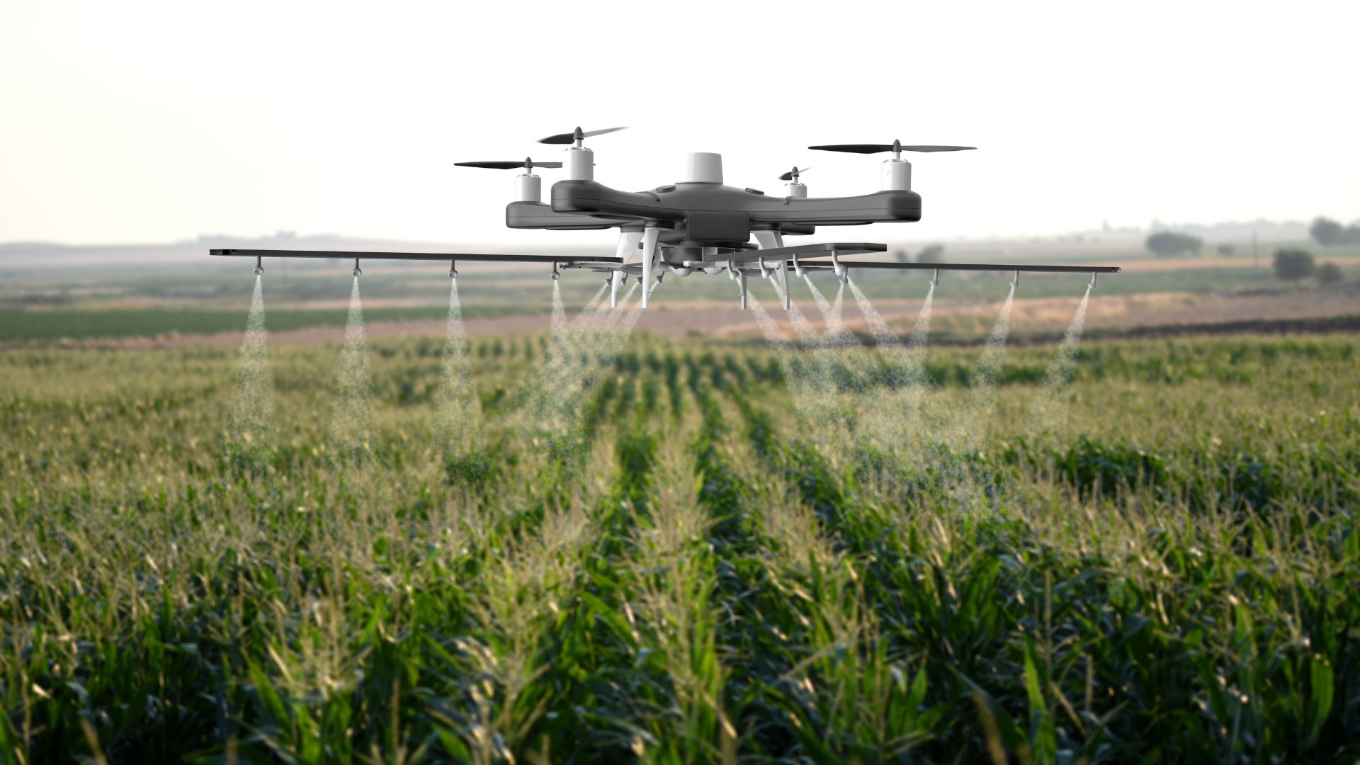
Crop spraying: Crop spraying is another agricultural practice where drone technology is used. When unmanned helicopters fitted with spraying apparatus and pesticide tanks were utilized to spray crop fields in Japan in the 1980s, the technology was first put into practice. The typical current spraying drones can cover a hectare in 10 minutes thanks to their over ten-liter liquid pesticide tank capacity and over-a-litre-per-minute discharge rate. However, in order to truly utilize drone technology as a spraying platform, the spraying must be linked and coordinated with the aforementioned imaging, processing, and automated analytics capabilities in order to treat the impacted regions or plants with accuracy. Such a strategy would result in both an improvement in dose in the troubled regions and a decrease in the general usage of pesticides in the region.
Automated drones with spraying capabilities are able to accomplish this immediately. Products that use drone technology to analyze NDVI index readings can help to pinpoint when to harvest certain crops. Drone-acquired high-tech aerial data combined with data from other sources, including weather predictions and soil maps, can assist to improve the final result, allowing the farmer to make the most of the farm and increase yields as far as they can go naturally. Even more significant for certain farms in the Asia-Pacific region is that drones make it possible to reach inaccessible and difficult-to-reach places, such terraced rice fields or fruit orchards in hilly terrain.
Mapping and Imaging Purpose: In order to better plan production and increase efficiency, the mapping and imaging capabilities of drone platforms with a variety of sensors may be employed at every stage of the production process. Drone technology may be used to evaluate the state of the soil before the growth cycle begins, hence determining prospective yields. Actual 3D mapping of the landscape with exact soil color coverage is the most important application for evaluating soil condition. This aids in accurately determining the moisture and water movement in the soil as well as the quality of the soil. Cyclic flights can be used to track crops and the agricultural process throughout the vegetative period, allowing planners to plan activities and respond quickly to problems as they arise.
Crop monitoring and inspection: Farmers may use drones to examine their crops from above, gathering data on the health of their crops, the presence of pests and diseases, and the requirement for irrigation. Making knowledgeable choices about crop management, such as when to use pesticides or fertilizers, is possible with the help of this information.
Seeding and planting: Using drones to sow seeds or plant seedlings can increase accuracy and efficiency. For planting crops in remote locations or on vast farms, this is very helpful.
Fertilizer and pesticide application: Drones may be used to apply fertilizers and pesticides more accurately than traditional techniques, which can assist to lessen the quantity of chemicals used and the environmental effect.
Weed control: By using drones to identify and target weeds, the usage of pesticides may be less necessary.
Livestock monitoring: Drones are able to count animals, look for wounds, and follow their movements when monitoring livestock. The welfare and productivity of animals can be enhanced using this knowledge.
Disaster management: Drones may be used to examine regions impacted by calamities like floods or fires in order to evaluate the damage and support relief operations.
This fact may ultimately lead to machines making choices about which plants need to be moisturized, treated with pesticides, or are ready for harvest, or conversely, which animal needs to be given antibiotics to stop the spread of disease throughout the herd. The fusion of the drone as a platform for multiple sensors and machine learning-based intelligent processing and analysis software would create a nearly unlimited number of options, maximizing productivity and further reducing the labor for humans. As a result, there would be a rise in productivity and a fall in the cost of agricultural goods, allowing the output gap to close and meet the demands of the expanding world population.
Contact:
If you have any questions, thoughts, or suggestions, please contact us or join our social media networks.
Email us: agribusinessedu@gmail.com, info@agribusinessedu.com
Feel free to comment:
Your email address will not be shared with anyone.
Join our LinkedIn group
https://www.linkedin.com/groups/13943442/
Join our Facebook group
https://www.facebook.com/groups/agribusinesseducationandresearchinternational
You may read:
What is Agricultural Technology? – Agribusiness Education and Research International
What is Sustainable Agriculture? – Agribusiness Education and Research International
Organic Agriculture Introduction – Agribusiness Education and Research International
Crop Protection Market and Trends – Agribusiness Education and Research International
https://agribusinessedu.com/planting-system-and-sustainable-agriculture/
Hydroponic Cultivation Systems – Agribusiness Education and Research International
What is Permaculture? – Agribusiness Education and Research International